Punta Arenas

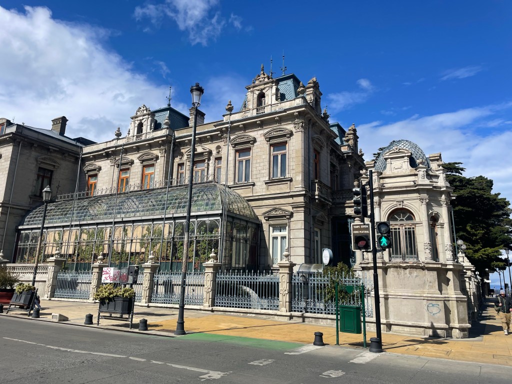
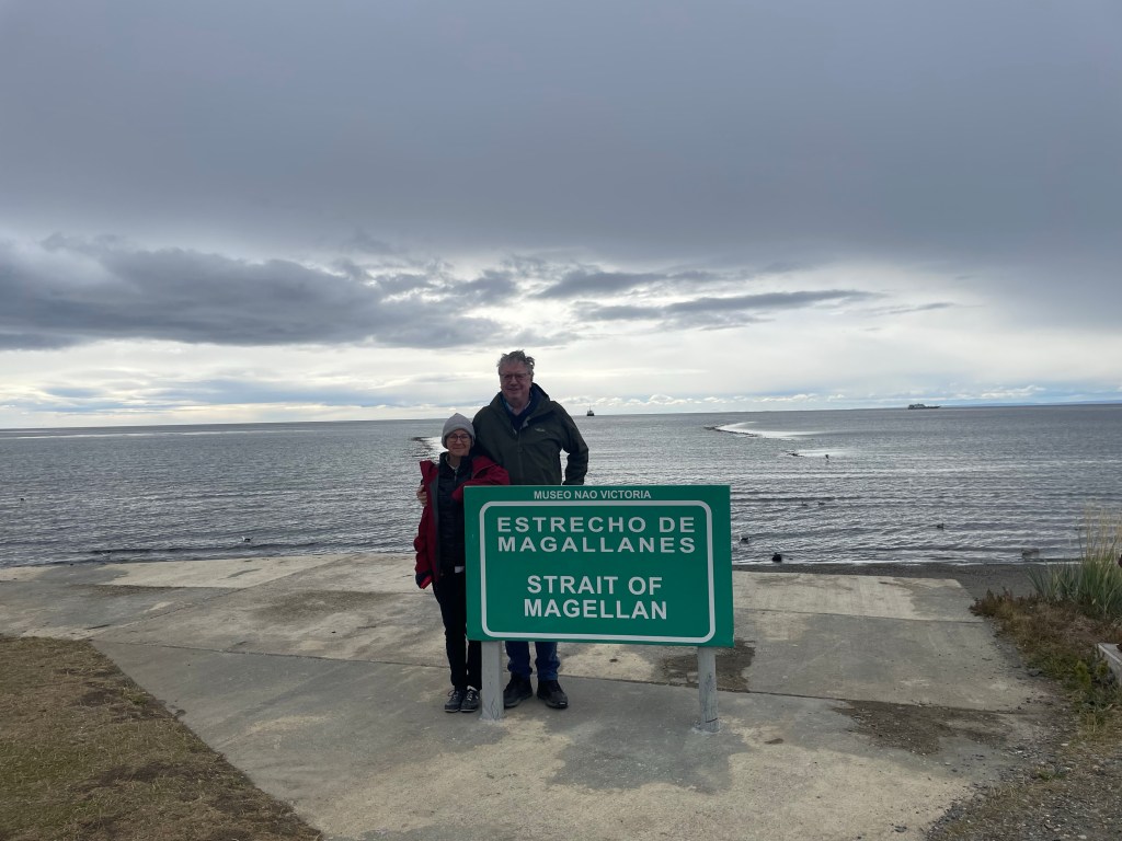
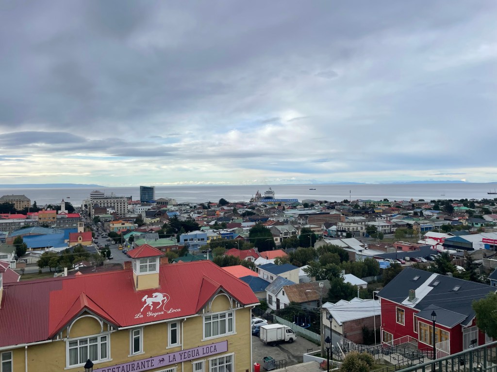
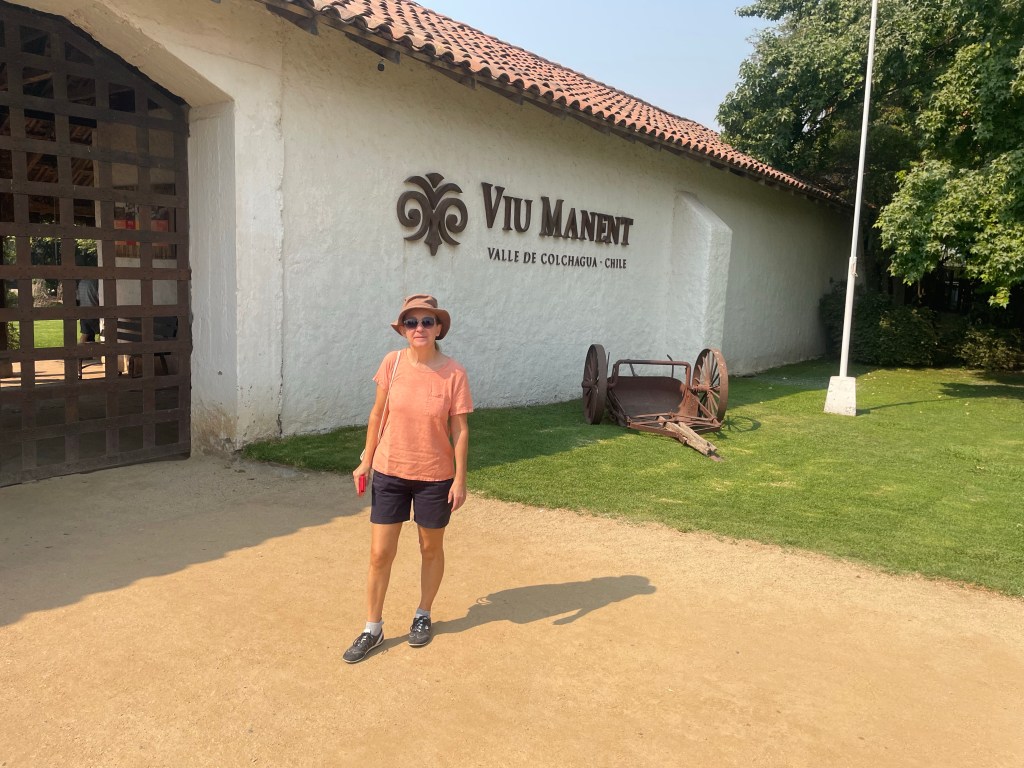
Punta Arenas (originally Sandy Point) is a three and a half hour flight due south from Santiago (for us a 4am departure from Colchugua Valley !). At 53 degrees south, it is the largest city south of 46 degrees. Although it is the same latitude south as Nottingham is north, it has a very different feel and climate as it is the gateway to Antarctica. It is situated on the north of the Magellan Straits (used by Magellan in the first circumnavigation of world in 1520) with views over Tierra Del Fuego. Its main economy was sheep farming, but is now oil, gas and tourism, making it a relatively wealthy part of Chile.

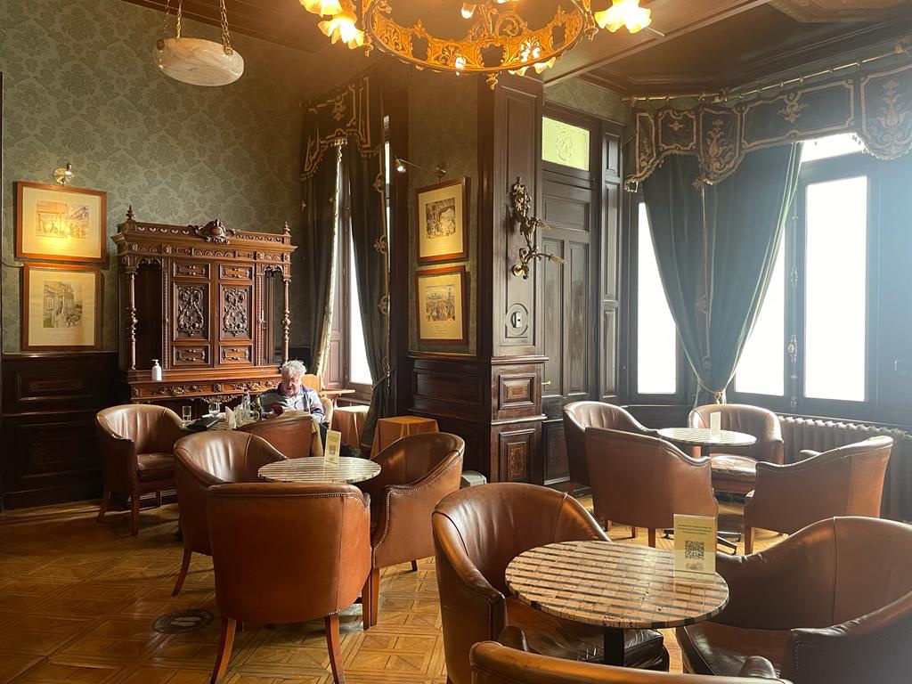
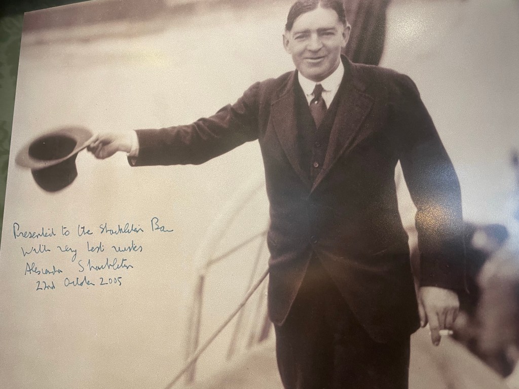
When Ernest Shackleton heroically securred the rescue of his Endurance crew, they were taken by the Chilean Navy to Punta Arenas. A celebratory dinner followed and Shackleton stayed as a guest in the mansion which was later converted into a hotel where we stayed.

The mansion of Sara Braun, now hotel Jose Nogueira (named after her husband)
The Ernest Shakelton Bar at Hotel Jose Nogueira
Shakelton’s granddaughter stayed at the hotel
The location of the celebratory dinner, now a bank

Colchagua Valley

Situated a two and a half hour drive from Santiago is the Colchagua Valley, one of the best known wine regions in Chile. It has a mediterranean climate and is best known for its full bodied red wines produced from Cabernet Sauvignon, Malbec, Syrah and Carmenere grapes. Wines were first bought to Chile in the 16th C by Spanish missionaries, however French grapes were introduced in the 19th C. Carmenere vines were wiped out in France in 1867 by disease and were thought to be extinct until rediscovered in Chile around 1990, having been previously mistaken for Malbec.

The Colchagua Valley has significant French influence, with many vineyards either owned by, or under the guidance of, French winemakers.

White wines are also produced, mainly from Chardonay or Sauvignon Blanc but they are not the same quality as the red wines.

Wine is Chile’s fifth largest export with China and the UK being the largest markets. There are three main classifications – Reserva (plonk), Gran Reserva (decent) and Icons (excellent and expensive). The better vineyards usually have excellent restaurants, making them doubly attractive !

The ‘classroom’ at the Viu Manent vineyard which has been run by the same family for three generations
Open kitchen as the Viu Manent restaurant
The Maquis vineyard. French winemakers are used as consultants and a Belgian expert was used to create a biosphere, including water management and specific planting
The Maquis vineyard produces specific wine for the Chinese market in outdoor tanks (steel and concrete) – they are made lower in alcohol and do not have the ‘Maquis’ label
Lunch in the restaurant at the Montes vineyard
Overlooking the Laura Hartwig estate

Piedras Rojas and High Plains lagoons

A two hour drive took us to Piedras Rojas, a salt lagoon at an altitude of 4,100m overlooked by the Andes. The mountains in the region are up to almost 6,000m in height – for comparison Mount Elbrus in Russia has highest point in Europe at 5,642m, Mont Blanc is the third highest at 4,809m. The mountains are volcanic, some dormant but some active with the last eruption in December 2022 and there is currently an orange warning, one before the maximum.

The lagoon is set amongst red rocks, hence the name. Our guide, Gaspar, took us on a gentle hike around part of the lagoon wary of the high altitude. Although not freezing, the wind chill made it seem very cold even in the bright sun.

We then visited the Miscanti and Miniques lagoons before heading off for a high altitude picnic among the rocks.

During the drive we passed the foothills of the active Lascar Volcano at almost 6,000m and crossed the Tropic of Capricorn (going west the tropic of Capricorn passes through Queensland and east of south America it passes through Namibia).

Vilama Valley

The Vilama River is the main water source for San Pedro de Atacama. We hiked to a hidden waterfall via steep rocky slopes at altitudes up to 3,400m. While not a long hike, this was the most strenuous and technically demanding hike we undertook due to the terrain and slope, but it was worth it for the scenery, waterfall and cacti.

The cacti are now protected, but were used by the locals as a source of wood as there were no trees and they have a hard wood centre. They grow very slowly, only 1m every 50 years, with deep roots searching for water. On our trip to the salt flats we had stopped at a small village where there was a church with a roof made from this type of cactus.

Quebrado del Diablo

This was intended to be a medium level hike to the Devil’s mouth and walk through a narrow canyon. We managed to do the difficult half before having to turn back when the guide found out that our car could not get to the pick up point because the road had disappeared. We managed to get to the lookout point but then had to do the difficult part in reverse, down the steep rocky mountainside. No injuries, a spectacular view and almost no one else on the route – well worth the effort (including on the guide’s part, taking care of our safety!).

Our guide showing the route
Ancient petroglyph
Lunch back at the lodge

Atacama Excursions

Our lodge provided half day and full day excursions in the desert, of varying levels of physical difficulty and altitude. Most of the excursions are between 2,400m and 3,400m but two are above 4,000m. Our initial plans were disrupted by the weather as roads were either flooded or blocked by snow and ice. To manage the altitude we planned the higher trips after a couple of days of acclimatisation as well as taking other advice, including no alcohol !

On our first day we visited Vallecito, which is a quiet part of Moon Valley. We then visited Salar de Atacama, the largest salt flat in Chile. We discovered that the mornings would be bright and sunny with clouds developing in the afternoon to give high winds and thunderstorms by late afternoon. At the salt flat we experienced rain and a sandstorm. The salt lake is home to flamingos feeding on 1cm long shrimps that inhabit the salty lagoon, giving the flamingos their pink colour.

The scenery of Moon Valley lends itself to film locations, including Quantum of Solace
The impact of wind and sand erosion
A former miners’ bus – the area was the site of a number of salt mines
Salt flats
Flamingos (if you look closely) and gathering storm clouds
Concurrent sand and thunderstorm

Atacama Desert

The Atacama Desert is a strip of land west of the Andes covering over 105,000 square km and is the driest non-polar desert in the world. According to the locals in a ten year weather cycle, it has eight dry years, a medium “wet” year and a “wet” year (wet being a relative term in the context of a desert which, by definition, has less than 25cm of precipitation per year). The wet season, the Altiplanic Winter, is in the summer and lasts up to two months. It is caused by the reversal of the wind direction, so that the wind flows across the Andes from Bolivia during what is known as the Bolivian winter, rather than the normal direction from the Pacific. The precipitation is very localised, falling as rain or snow, depending on the altitude; it is believed that parts of the desert have not had any rain in 500,000 years

We stayed in San Pedro, an oasis in the desert, during one of the medium wet “winters”, at an altitude of 2,400m. It is the centre for tourism with a population of almost 5,000. The other main industry in the area is mining, predominantly copper and lithium. The lithium mining is controversial as it uses a lot of water and consequently is not good for the ecosystem. The lithium is exported, mainly to China for the production of batteries.

Most tourists and miners fly into Calama (the mining centre) from Santiago, a two hour flight – hiking gear and hard hats being the carry on luggage of choice.

Lithium mine
Calama
From our lodge – Licancabur (extinct) volcano, on the border with Bolivia at 5,916m, in the background.
Rainbow in desert
The snow capped mountains, also on the Bolivian boarder

Valparaiso

Valparaiso has been described as a dilapidated, colourful, poetic wonderful mess. From the times of Spanish colonialism and English seamen, including Sir Francis Drake, it was a major stopping off port for ships rounding Cape Horn. During the Califonian gold rush of 1849, mining supplies came through Valparaiso. It lies on the coast, 116km from Santiago, but with a very different climate – the day we visited, Santiago reached 36 C and Valparaiso 22 C, with cloud and a cold wind until lunchtime.

The Chilean navy was founded here with the first Vice Admiral being Lord Cochrane, who had been a captain in the Napoleonic wars, but was convicted of Stock Exchange fraud. Valparaiso is still home to the naval acadamy and was a major influence on Chile winning the Pacific War against Bolivia and Peru in the late 19th century, resulting in Chile incresing its land by 30%.

Following the opening of the Panama canal it declined, but the city built on steep hills remains colourful and artistic with separate districts for each of the immigrant European nations, reflecting their respective architechture. These include British, German, Yugoslavian, French, Swiss and Italian. It remains a significant port and is a large student city with several universities.

One of several funiculars built around 1900 to help get around the city
Many buildings are decorated with murals
A church in the German district
The port
House built by a wealthy Yugoslav merchant
The “Armada de Chile” building
The headquarters of the shipping authority- the building could not be repaired after an earthquake in 2017, so a glass building was built inside the existing exterior
Fish lunch with our guide

Santiago

Santiago is the capital city of Chile, founded by the Spanish in 1541, with a population of nearly seven million (Chile’s total population is approx 19m). Chile became independent in 1818 and its first leader was Bernardo O’Higgins (explaining the number of O’Higgins road/square names). He was the illigitimate son of an Irishman who served in the Spanish Army and became a wealthy landowner in Chile.

The city still bears the aftermarth of the military takeover by Augusto Pinochet in 1973 supported by the CIA. The marxist elected president Salvador Allende committed suicide rather than being captured. Pinochet’s regime came to an end in 1990 and democracy returned to Chile.

Entrance to the fortifications on the top of St Lucia Hill
View from St Lucia hill
St Francis of Assisi parish church – the Oldest Church in Santiago
“Paris Londres” district of Santiago – a number of the buildings were gathering places for socialists during the Pinochet years
A metro station
Santiago’s financial district with its flat iron building. There is also a newer financial district further out of the centre
Statue of Salvador Allende outside the Presidential Palace (used as offices, no longer a residence)
Funicular at the Metropolitan Park
From the restaurant on our last night in Santiago

Chile

Chile is almost 2,700 miles long, stretching from the dryest desert in the world to the most southerly mainland in the world, yet, its average width is only 109 miles. The diversity is incredible with active volcanos (the worlds highest volcano at 6,891m is in Chile), geysers, earthquakes, vineyards and glaciers. This in turn is reflected in the diversity of climates and wildlife.

If a map of Chile is superimposed on Europe, it stretches from the most northern point of Norway to the coast of Libya. The same exercise with Chile turned on its side, in relation to the US shows the length of Chile as equating to New Hampshire to San Francisco.