Glacier Perito Moreno

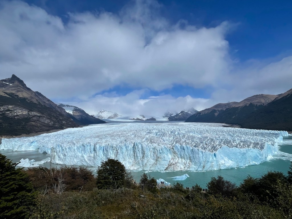
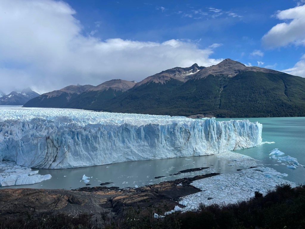
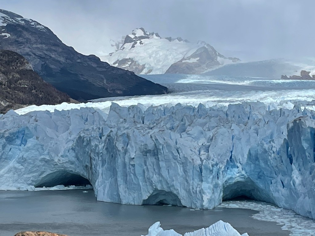
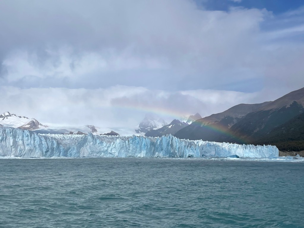
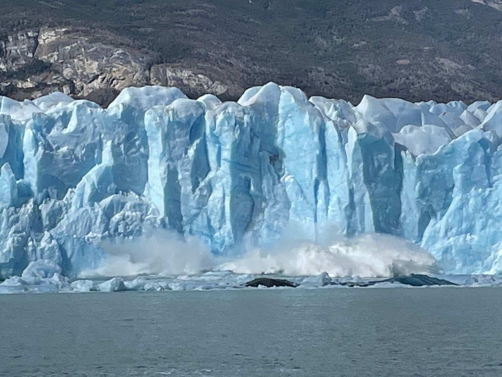
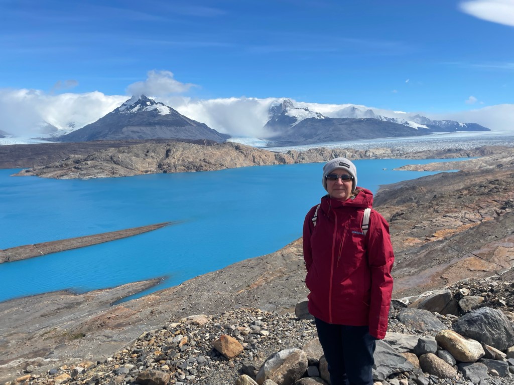
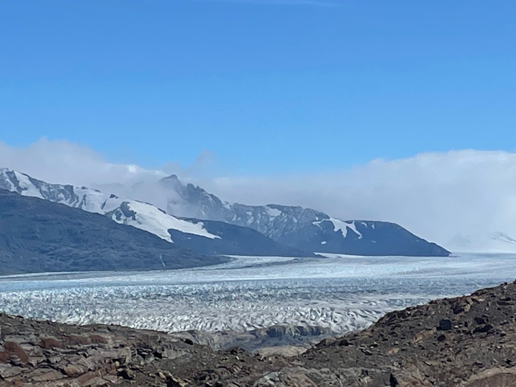
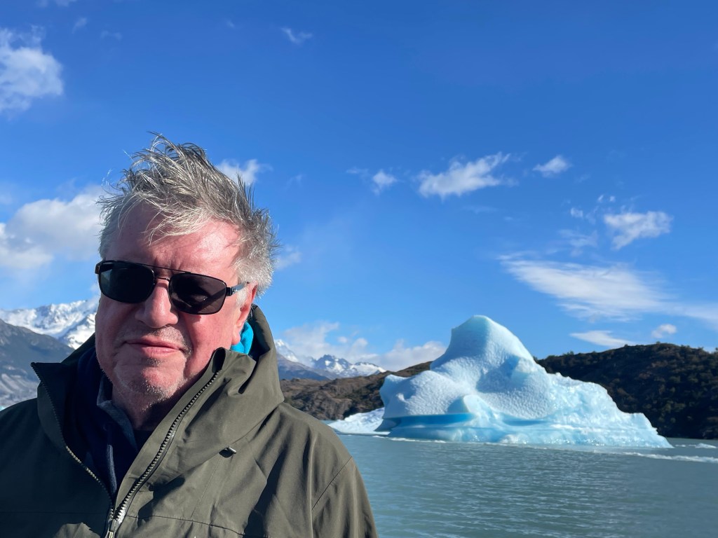
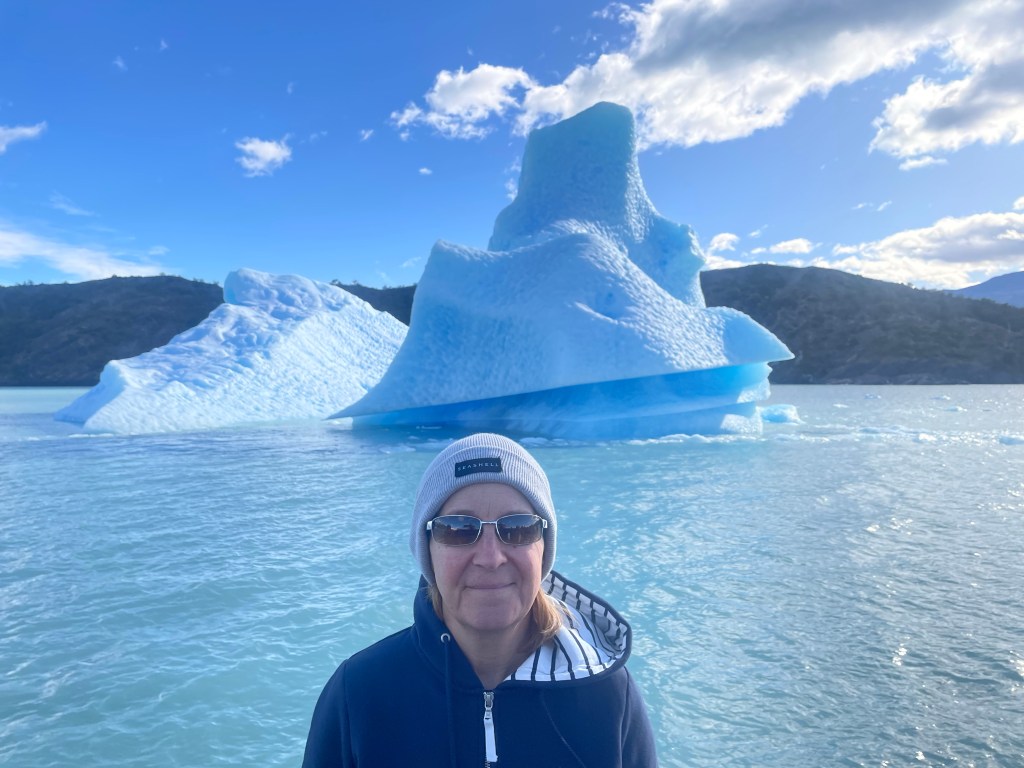
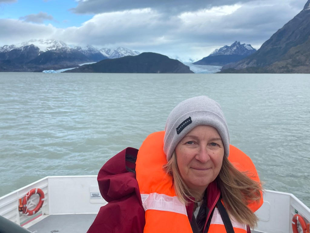
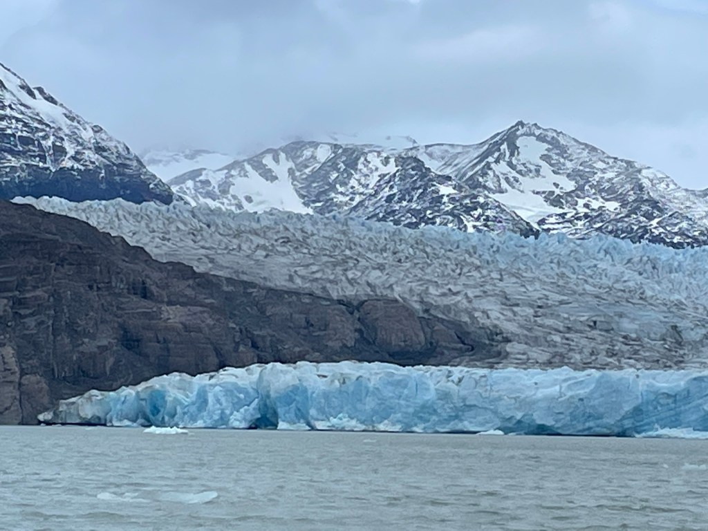
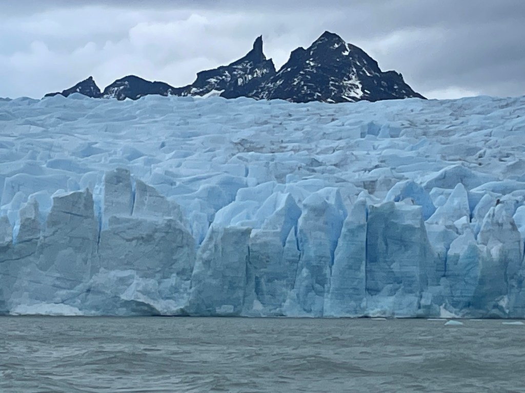
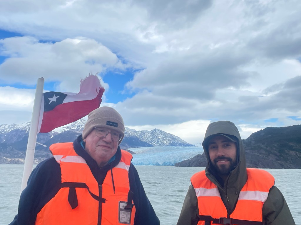
Perito Moreno is the main attraction in the Los Glaciers National Park. Named after the explorer who discovered Lake Argentina (“Perito” is a nickname meaning explorer), but who never saw the glacier. It is 30km long, 5km wide and at its highest 70m (Nelson’s column is 51m). It is one of the few glaciers considered stable, although this is currently under review (the locals think it is shrinking). It moves at two meters per day at its centre and is regularly producing icebergs. It can be viewed from a boat, at a safe distance, and from 4.7 km of walkways on the opposite land. We did both.

Glacier ‘caves’
As our boat departed a Patagonian shower resulted in a rainbow
The splash of a ‘calving’

Estancia Cristina and the Upsala Glacier

Estancia (a ranch) Cristina was founded in 1914 by Englishman Joseph Masters who came to Argentina, with his wife and young family, in search of gold but only found iron pyrites. His daughter, Cristina died at the age of 22 and the Estancia was named after her. His son had no children, so the Estancia became part of the Los Glaciares National Park. It can only be reached by boat across Lake Argentina – a two hour journey but in the days of the Masters much longer and therefore essentially cut off. Furthermore, the Masters would have not had the sonar equipment used by our boat to understand the underwater dimensions of the icebergs.

From the Estancia, Upsala Glacier can be reached by a combination of a precarious drive in a 4X4 and a hike. The track was opened up by scientists observing the glacier. We had lunch at the Estancia before the boat trip back across the lake, but it has a few cabins used by hikers and scientists.

Lake Argentina

We travelled from Chilean Patagonia to Argentinian Patagonia by car. In a direct line 60 miles, but by road over 170 miles and six hours, including the border crossing. We arrived at the border just after two local coaches (it was the weekend and there was a festival), so it took an hour to leave Chile. In the five miles between the the Chilean and Argentinian border controls, our driver earned his tip by overtaking one of the coaches, so the Argentinian control took a matter of minutes.

Our first hotel in Argentina overlooked Lake Argentina. The lake would have been discovered by Charles Darwin, who was travelling up the Santa Cruz river, searching for its source, but he was forced to turn back due to dwindling supplies. The lake was discovered 40 years later (but in Darwin’s lifetime) in 1877 by the Argentinian explorer, Francisco Moreno. He named it Lake Argentina, in part, to ensure it sat on the right side of the border with Chile in a treaty of 1881.

The Argentinian border control
Lake Argentina is 60 km long and up to 20 km wide
We departed from the airport at El Calafate on the shore of Lake Argentina
We could see the three towers, close to where we had stayed in Chile, from our hotel
Hiking above our hotel

Grey Glacier

The Southern Patagonian Ice Field is the second largest non-polar ice field and has many glaciers in both Chile and Argentina. We visited three, the first being Grey Glacier in Chile. It feeds Grey Lake which gets its name from the colour created by the sedimentary silt deposited by the glacier.

With our guide, Diego
A fellow visitor at our lunch stop – a Magellanic woodpecker

Hiking in Torres del Paine

Our lodge organised hikes, which ranged in difficulty from easy to “you must be joking”. The scenery and wildlife was incredible. One of the highlights was seeing a pair of pumas with a cub lying on their backs in the grass – sadly too distant for a photo on an iphone.We completed four easy/medium difficulty half day hikes in all weather conditions, the most challenging being a visit to a site with ancient rock art. We rarely saw other hikers as the National Park is so vast.

Short eared owl (photo credit to our guide)
Location of the rock paintings

Torres del Paine

Torres del Paine is a national park in Southern Chilean Patagonia. It is almost 200 miles from Puento Arenas and is an area of mountains, glaciers, lakes and forests. At 1,800 square km, it is similar in size to Hertfordshire. The centrepiece is the Paine Masif with its three grantite towers, which are at an altitude of around 2,500 metres. The middle tower was first climbed by Chris Bonnington and Don Whillans in 1963.

Our lodge, just outside the park, with spectacular views of Lake Sarmiento and the three towers provided guided hiking excursions.

The lodge – built into the landscape with local materials and no roads or other buildings in sight
View from one of the sitting rooms
The three towers
A fossilised shell
Salto Grande waterfall

Patagonia

Patagonia is a region of over 1 million square km – over four times the size of the UK and a third larger than Turkey. Approximately 90% of the region is in Argentina, with the rest in Chile. It sits at the south of South America and is surrounded by the Atlantic and Pacific Oceans with the Andes providing a backbone down the western side and acting as a border. Over the years there have been various disputes over the border with the most recent being adjudictaed by the Pope in the 1980s. With a population of just under 2 million, it is one of the least populated areas of the world (similar to Mongolia).

Despite the mountains, most of the land is designated a steppe. The combination of mountains, steppes and oceans creates very varied weather condistions, frequently with all four seasons in a day. Although we visted in summer, we experienced sun, showers, snow and wind. Temperatures ranged from just above freezing to mid teens but with considerable wind chill at times. We soon discovered that a “Patagonian breeze” is the sort of wind that you have to lean into to stay upright !

A Patagonian traffic jam
A typical ‘Estancia’ – small holding/ranch
Steppes
Guanaco (similar to Lama)
This Gunaco was killed by a puma – once the puma had enjoyed a meal or two the scavenger birds move in – this one is a caracara

Punta Arenas

Punta Arenas (originally Sandy Point) is a three and a half hour flight due south from Santiago (for us a 4am departure from Colchugua Valley !). At 53 degrees south, it is the largest city south of 46 degrees. Although it is the same latitude south as Nottingham is north, it has a very different feel and climate as it is the gateway to Antarctica. It is situated on the north of the Magellan Straits (used by Magellan in the first circumnavigation of world in 1520) with views over Tierra Del Fuego. Its main economy was sheep farming, but is now oil, gas and tourism, making it a relatively wealthy part of Chile.

When Ernest Shackleton heroically securred the rescue of his Endurance crew, they were taken by the Chilean Navy to Punta Arenas. A celebratory dinner followed and Shackleton stayed as a guest in the mansion which was later converted into a hotel where we stayed.

The mansion of Sara Braun, now hotel Jose Nogueira (named after her husband)
The Ernest Shakelton Bar at Hotel Jose Nogueira
Shakelton’s granddaughter stayed at the hotel
The location of the celebratory dinner, now a bank

Colchagua Valley

Situated a two and a half hour drive from Santiago is the Colchagua Valley, one of the best known wine regions in Chile. It has a mediterranean climate and is best known for its full bodied red wines produced from Cabernet Sauvignon, Malbec, Syrah and Carmenere grapes. Wines were first bought to Chile in the 16th C by Spanish missionaries, however French grapes were introduced in the 19th C. Carmenere vines were wiped out in France in 1867 by disease and were thought to be extinct until rediscovered in Chile around 1990, having been previously mistaken for Malbec.

The Colchagua Valley has significant French influence, with many vineyards either owned by, or under the guidance of, French winemakers.

White wines are also produced, mainly from Chardonay or Sauvignon Blanc but they are not the same quality as the red wines.

Wine is Chile’s fifth largest export with China and the UK being the largest markets. There are three main classifications – Reserva (plonk), Gran Reserva (decent) and Icons (excellent and expensive). The better vineyards usually have excellent restaurants, making them doubly attractive !

The ‘classroom’ at the Viu Manent vineyard which has been run by the same family for three generations
Open kitchen as the Viu Manent restaurant
The Maquis vineyard. French winemakers are used as consultants and a Belgian expert was used to create a biosphere, including water management and specific planting
The Maquis vineyard produces specific wine for the Chinese market in outdoor tanks (steel and concrete) – they are made lower in alcohol and do not have the ‘Maquis’ label
Lunch in the restaurant at the Montes vineyard
Overlooking the Laura Hartwig estate

Piedras Rojas and High Plains lagoons

A two hour drive took us to Piedras Rojas, a salt lagoon at an altitude of 4,100m overlooked by the Andes. The mountains in the region are up to almost 6,000m in height – for comparison Mount Elbrus in Russia has highest point in Europe at 5,642m, Mont Blanc is the third highest at 4,809m. The mountains are volcanic, some dormant but some active with the last eruption in December 2022 and there is currently an orange warning, one before the maximum.

The lagoon is set amongst red rocks, hence the name. Our guide, Gaspar, took us on a gentle hike around part of the lagoon wary of the high altitude. Although not freezing, the wind chill made it seem very cold even in the bright sun.

We then visited the Miscanti and Miniques lagoons before heading off for a high altitude picnic among the rocks.

During the drive we passed the foothills of the active Lascar Volcano at almost 6,000m and crossed the Tropic of Capricorn (going west the tropic of Capricorn passes through Queensland and east of south America it passes through Namibia).